Remote observation & control
Perform suitable observation, survey or collection tasks from an unmanned platform with defined supervision.


Warpify integrates surface cleaning robots, survey USVs and underwater inspection robots for waterway operators, asset owners and marine service teams. We combine platform and payload selection with control systems, deployment planning, training and lifecycle support.
Connect the right vessel or underwater vehicle with the equipment and operating plan for your mission. Surface cleaning, bathymetric surveys and submerged-asset inspection need different configurations.
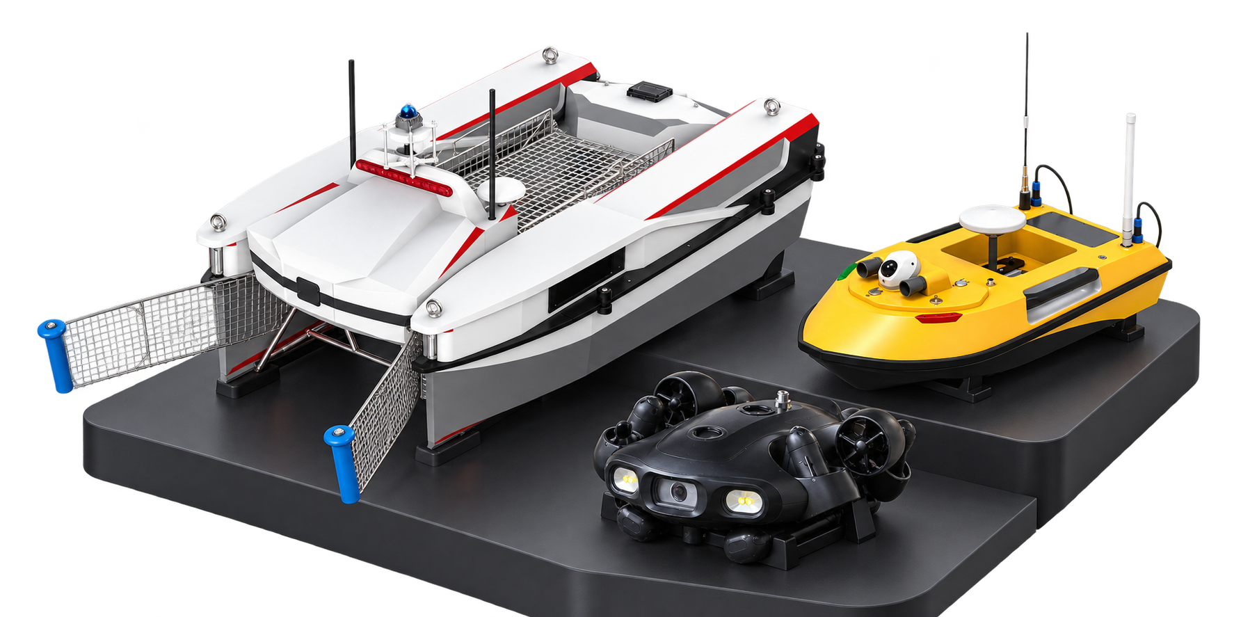
A USV works on the water surface, a tethered ROV gives an operator underwater access, and an AUV follows a planned underwater mission. Choose the operating mode around the task and recovery needs.
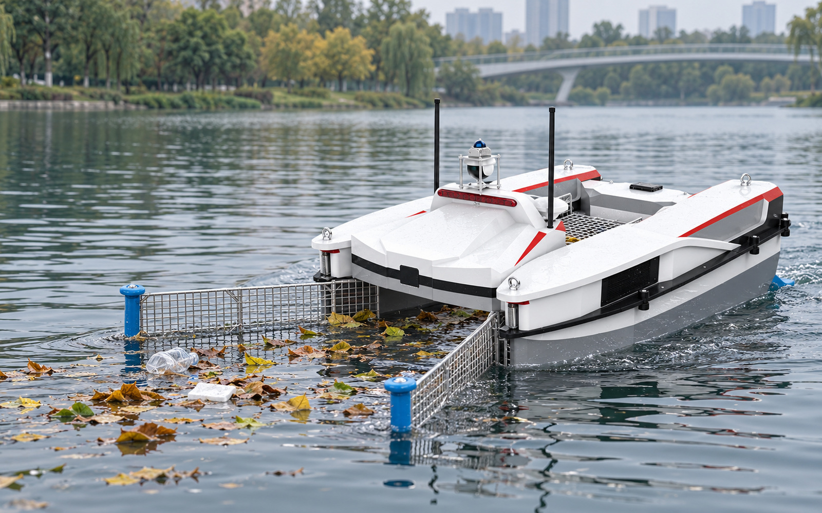
For lake and river cleaning, use an unmanned surface vehicle (USV) with a collection system for leaves and floating litter. Survey configurations use an echo sounder, flow instrument or water-quality sensor. Confirm draft, launch access, traffic, positioning and communications.
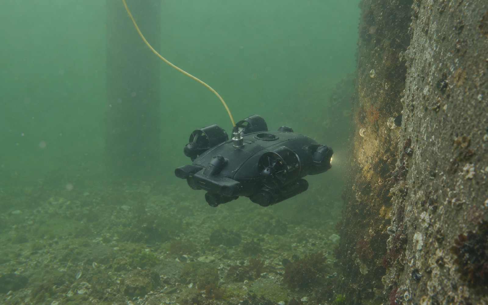
A remotely operated vehicle (ROV), also called an underwater drone, connects to a topside operator through a tether. Select camera, lighting, sonar or tools around the target. Confirm depth, current, visibility, tether routing and retrieval.
An autonomous underwater vehicle (AUV) uses onboard navigation for planned wider-area survey or search. Scope its payload, mission review and recovery separately from a tethered inspection ROV.
Plan the complete operating loop, from the required output to launch, supervision, recovery and data review. Assign robot functions and human responsibilities before mobilization.
Map the water area, target output, access points and current method.
Select the vehicle, payload, positioning, power and control.
Check conditions, communications, tether handling and recovery access.
Follow the mission plan, monitor conditions and log interventions.
Retrieve the system; check the vehicle, payload and collected material.
Verify coverage, data quality and total effort before repeating.
Test the intended gains in a representative pilot. Compare accepted output and total effort under the actual site conditions.
Perform suitable observation, survey or collection tasks from an unmanned platform with defined supervision.
Use consistent routes, targets, sensor settings and acceptance criteria across visits.
Plan launch, operating windows, communications, payload care and retrieval.
Review usable output alongside preparation, interruptions, processing and rework.
Match the required deliverable to the water area, asset geometry and payload. These applications use distinct equipment and operating procedures.
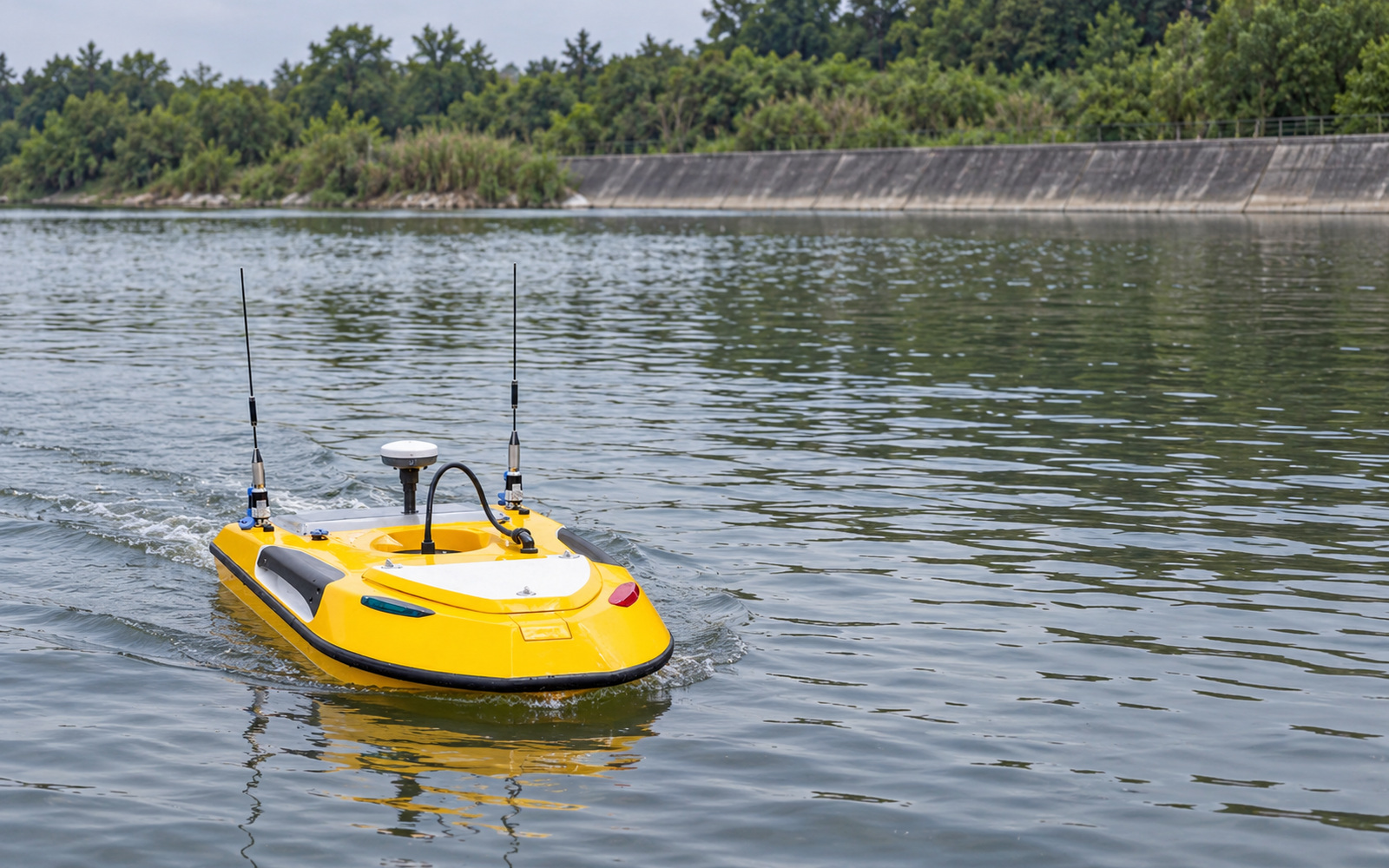
Configure a survey USV for hydrographic mapping, water-depth measurement or flow surveys. Define the echo sounder or acoustic Doppler current profiler (ADCP), calibration, positioning, survey lines and data format.

Record submerged hull or waterfront-asset conditions with a suitable ROV. Match camera, lighting or imaging sonar to visibility, clearance and the inspection evidence required. Coordinate tether routing and access with asset operations.
Depth, current, visibility, launch access, vessel traffic, net hazards, communications, payload, data outputs and recovery arrangements determine platform fit.
Compare the same workload and acceptance standard. A relevant quotation covers the complete operating solution, not the vehicle alone.
Use accepted survey coverage, inspected targets or collected material as the denominator. Include data review and repeat work.
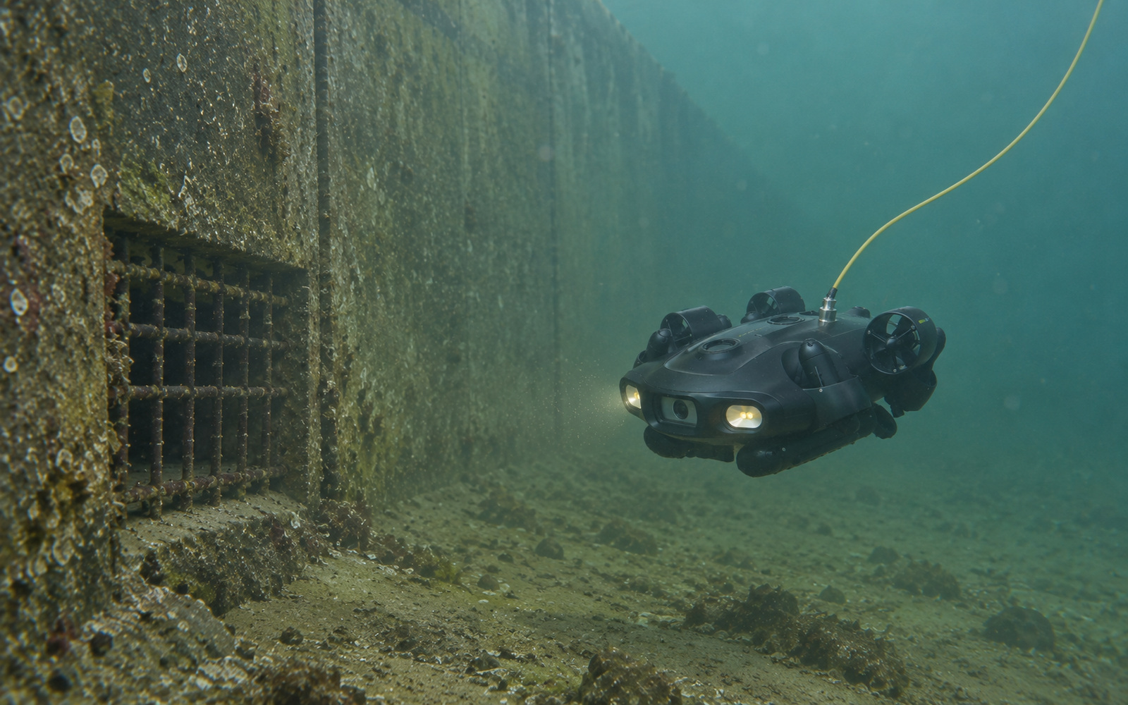
Define the target list, location records and required evidence. Match the ROV, imaging or sonar, positioning and retrieval method to the structure and water conditions.
Record task frequency, access and vessel costs, preparation, supervision, recovery, data review and rework.
Include vehicle, payload, control/tether equipment, integration, commissioning, training, batteries, spares and maintenance. Compare purchase and service options against frequency and local support.
One coordinated package connects platform, payload, control, data outputs and operating team. Agree equipment, interfaces, deployment responsibilities and acceptance before delivery.
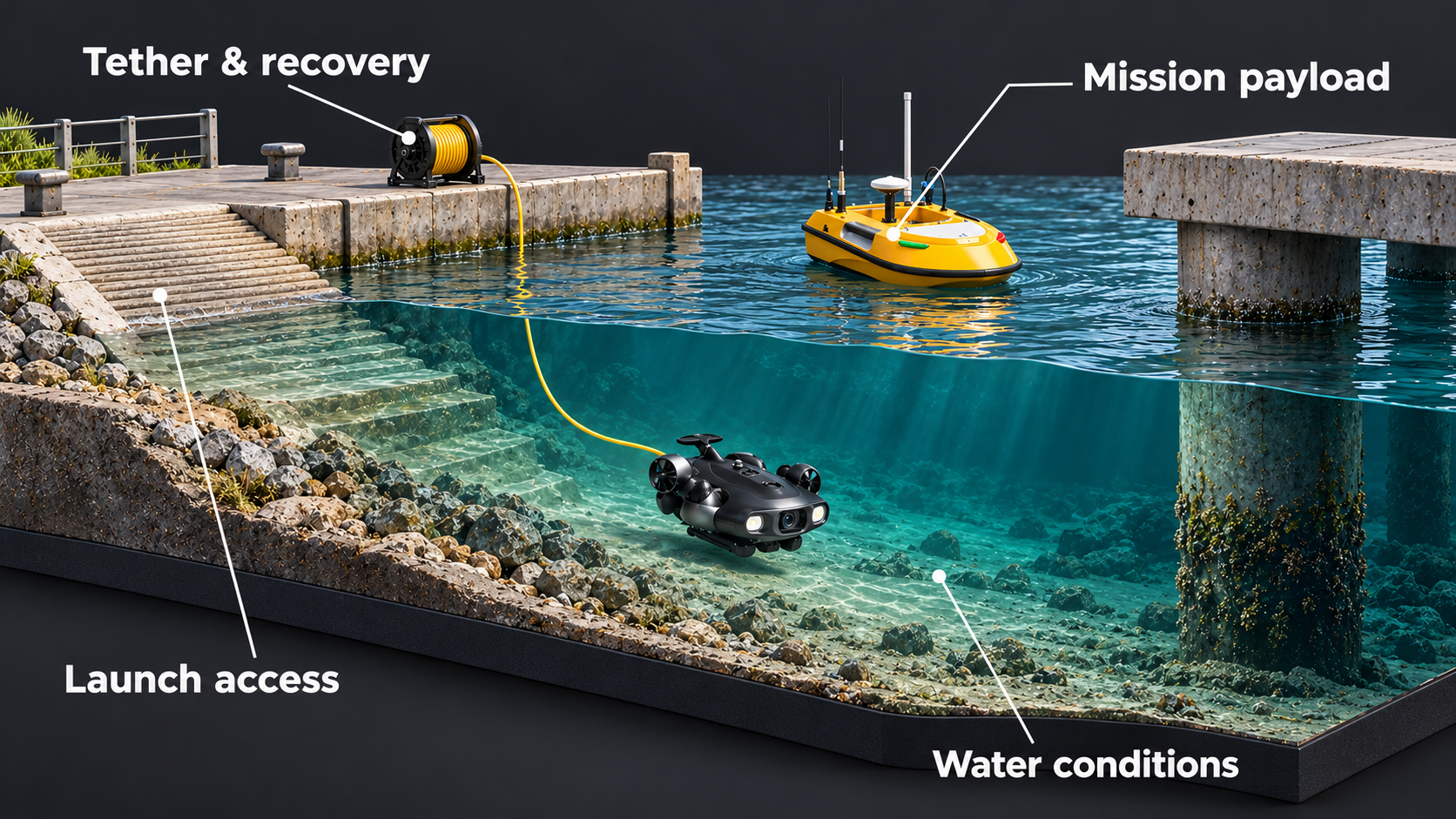
Define the water area, asset, output and recurring workload.
Match the USV, ROV or AUV, instruments and topside equipment.
Scope power, communications, positioning, exports, launch and recovery.
Verify output and operating effort, commission the system and prepare operators.
Agree equipment care, consumables, spares, maintenance and escalation ownership.
Agree acceptance before launch. Include conditions and targets that could affect output, control or retrieval.

Use a suitable ROV to observe nets and submerged structures with clearance from the mesh. Environmental monitoring or sampling requires a task-specific probe or sampler and collection protocol.
Agree coverage, targets or samples, usable imagery or sensor data, location records and export format.
Measure preparation, supervision, recovery and review. Demonstrate communications, stop conditions and retrieval.
Name the operators and confirm equipment care, spares, maintenance and escalation responsibilities.
Platform differences, payloads, operating limits and cost: the answers that shape a practical marine robotics project.
A USV is an unmanned surface vehicle. An ROV is a tethered remotely operated underwater vehicle controlled from topside. An AUV uses onboard navigation to follow a planned underwater mission. Select the platform around the job, access, required feedback and recovery.
Usually these are different configurations. Floating litter needs a collection interface; underwater inspection needs suitable imaging or sensing, control and retrieval. Specify each task before selecting equipment.
Yes, where compatible with the selected platform and mission. Confirm payload capacity, interfaces, power, calibration, data requirements and operating conditions. Optional tools are not standard on every vehicle.
Surface systems may use radio or cellular links with GNSS. Tethered ROVs exchange control and data through the tether. GNSS does not work underwater, so underwater positioning and AUV navigation need a task-specific approach.
Limits depend on the selected vehicle, payload and site. Review rated depth, current, visibility, target clearance, communications and recovery together. No single rating applies to every underwater robot.
Yes. Assign planning, launch, supervision, exception handling, recovery and equipment care. Autonomous functions do not remove operating responsibilities.
Cost depends on the vehicle, payload, positioning, topside equipment, integration, commissioning, training and support. Share mission frequency, site conditions and required output for a relevant purchase or service quotation.
These need separate platform and payload configurations, operating procedures and recovery arrangements. Confirm the task and applicable requirements before including them in a cleaning, survey or inspection solution.
Share the output your team needs. We will scope the platform, payload, deployment requirements and a pilot with clear acceptance criteria.
Marine project planning resources
Explore adjacent solutions, ownership models and local service-partner opportunities.
Compare adjacent inspection, security and other robotics applications.
Explore all solutions →Operating modelExplore ownership, operating responsibilities and Robotics-as-a-Service models.
Explore RaaS →Partner opportunityDiscuss customer access, field capability, deployment support and lifecycle service responsibilities.
Discuss a partnership →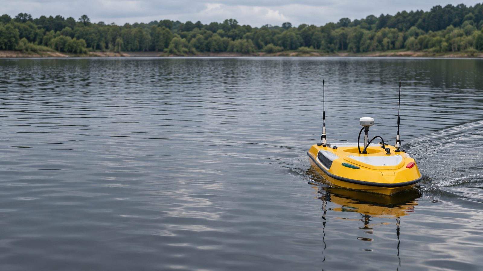
SURFACE & UNDERWATER ROBOTICS SOLUTIONS
Bring the task, water conditions and required result. We will connect the platform, payload, deployment plan and lifecycle support around your operation.
©2026 Warpify Robotics. All rights reserved.